KATHMANDU – A new drone image from Nepal’s Chochen Khola area has shown that most of the water collected inside an impact crater has drained away, but unstable ice formations around the site could still collapse and create further hazards, according to China’s Ministry of Water Resources.
Chinese state broadcaster CCTV News, citing the ministry, reported on Tuesday that authorities are continuing to assess risks following the recent mud-and-debris flood in Gyirong County of the Xizang (Tibet) Autonomous Region, close to the Nepal-China border.
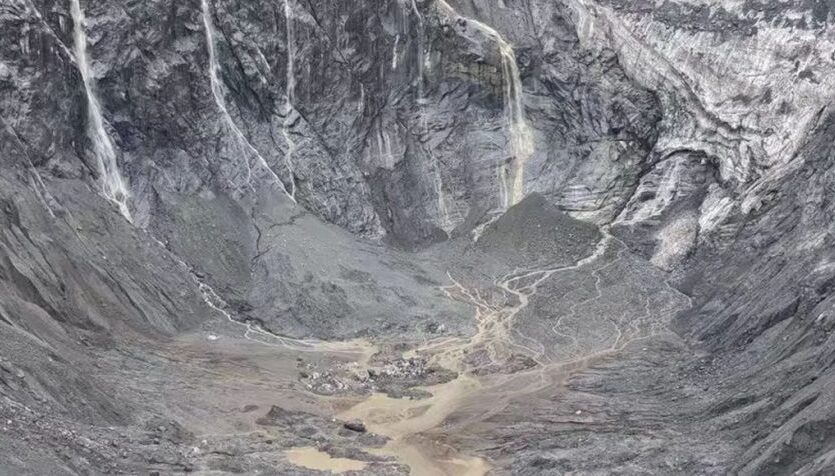
The latest drone image, captured at around 5:45 am Nepal time on Tuesday, showed that most of the water accumulated inside the impact crater at Chochen Khola had already flowed out. The ministry also reported that river flow in downstream areas had returned to normal.
However, the improved water situation does not mean that all risks have passed. According to the assessment, ice and glacial formations surrounding the crater remain unstable, leaving the possibility of further collapse and potential danger to downstream areas.
Chinese authorities are also monitoring the wider region through remote-sensing imagery. A recent comparison of images of 14 previously identified glacial lakes in the Gyirong Zangbo river basin found no significant change in their surface-water areas, suggesting that the lakes currently remain generally stable.
The Ministry of Water Resources said it will continue monitoring, technical assessments and expert consultations to identify any changes that could increase risks in the affected region.
The latest findings suggest that although water trapped at the crater has largely drained and downstream river flow has normalised, continued monitoring remains necessary because of the possibility of further ice collapse.
Photo Source: OnlineKhabar